 www.geodatenkatalog.de (S3F)
Keyword
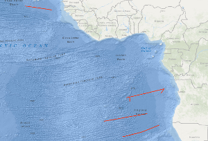
West Africa
12 record(s)
Provided by
Type of resources
Topics
Keywords
Contact for the resource
-
While climate information from General Circulation Models (GCMs) are usually too coarse for climate impact modelers or decision makers from various disciplines (e.g., hydrology, agriculture), Regional Climate Models (RCMs) and Regional Earth System Models (RESMs) provide feasible solutions for downscaling GCM output to finer spatiotemporal scales. However, it is well known that the model performance depends largely on the choice of the physical parameterization schemes, but optimal configurations may vary from region to region. Besides land-surface processes, the most crucial processes to be parameterized in ESMs include radiation (RA), cumulus convection (CU), cloud microphysics (MP), and planetary boundary layer (PBL), partly with complex interactions. Before conducting long-term climate simulations, it is therefore indispensable to identify a suitable combination of physics parameterization schemes for these processes. Using the European Centre for Medium-Range Weather Forecasts (ECMWF) reanalysis product ERA-Interim as lateral boundary conditions, we derived an ensemble of 16 physics parameterization runs for a larger domain in Northern sub-Saharan Africa (NSSA), northwards of the equator, using two different CU-, MP-, PBL-, and RA schemes, respectively, using the Weather Research and Forecasting (WRF) model (Version v3.9) for the period 2006-2010 in a resolution of 0.1 degree horizontal resolution. Conclusions about suitable physical parameterization schemes may vary within the study area. We therefore want to stimulate the development of own performance evaluation studies for climate simulations or subsequent impact studies over specific (sub-)regions in NSSA. For this reason, selected climate surface variables of the physics ensemble (i.e. the 16 experiments from 2006-2010) are provided. For more information about the setup of the experiments, please see: Laux et al., 2021: A high-resolution regional climate model physics ensemble for Northern sub-Saharan Africa. Frontiers in Earth Science (under revision).
-
This experiment (2006-2100) uses the data from the WRF60_mpiesm_rcp45 experiment as forcing data for downscaling to 12km resolution by the regional model WRFV3.5.1 for the region of West Africa. 'rcp45' is an experiment of the CMIP5 - Coupled Model Intercomparison Project Phase 5 (https://pcmdi.llnl.gov/mips/cmip5). 4.1 rcp45 (4.1 RCP4.5) - future projection (2006-2300) forced by RCP4.5. Experiment design:https://cera-www.dkrz.de/WDCC/ui/Entry.jsp?acronym=Taylor_CMIP5_design.pdf . This experiment is divided into several time slices of 11 years. The first year of each time slice is used as a spin-up phase and should not be used in the analysis. All experiments with MPIESM forcing refer to a Gregorian calendar. The 12 km resolution of this experiment is the second step of the two step downscaling WRF experiment.
-
While climate information from General Circulation Models (GCMs) are usually too coarse for climate impact modelers or decision makers from various disciplines (e.g., hydrology, agriculture), Regional Climate Models (RCMs) and Regional Earth System Models (RESMs) provide feasible solutions for downscaling GCM output to finer spatiotemporal scales. However, it is well known that the model performance depends largely on the choice of the physical parameterization schemes, but optimal configurations may vary from region to region. Besides land-surface processes, the most crucial processes to be parameterized in ESMs include radiation (RA), cumulus convection (CU), cloud microphysics (MP), and planetary boundary layer (PBL), partly with complex interactions. Before conducting long-term climate simulations, it is therefore indispensable to identify a suitable combination of physics parameterization schemes for these processes. Using the European Centre for Medium-Range Weather Forecasts (ECMWF) reanalysis product ERA-Interim as lateral boundary conditions, we derived an ensemble of 16 physics parameterization runs for a larger domain in Northern sub-Saharan Africa (NSSA), northwards of the equator, using two different CU-, MP-, PBL-, and RA schemes, respectively, using the Weather Research and Forecasting (WRF) model (Version v3.9) for the period 2006-2010 in a resolution of 0.1 degree horizontal resolution. Conclusions about suitable physical parameterization schemes may vary within the study area. We therefore want to stimulate the development of own performance evaluation studies for climate simulations or subsequent impact studies over specific (sub-)regions in NSSA. For this reason, selected climate surface variables of the physics ensemble (i.e. the 16 experiments from 2006-2010) are provided. For more information about the setup of the experiments, please see: Laux et al., 2021: A high-resolution regional climate model physics ensemble for Northern sub-Saharan Africa. Frontiers in Earth Science (under revision).
-
The experiment aims to investigate how the representation of convection influences the West African Monsoon during the mid-Holocene. Atmospheric and SST input data originate from the MPI-ESM Holocene simulations reflecting Holocene condition. External Parameters (surface condition) reflect present-day conditions similar to the experimental setup of PMIP1: The Sahara remains a desert. We use the ICON (ICOsahedral Nonhydrostatic) model framework version 2.5.0 (see Zängl et al. (2014) for more details). The provided data covers one simulation from June to October (JJASO) for the year 7023 before present (BP) with the year 2000 as the reference year. The time axes of the NetCDF files reflect the model year which is based on the time axes of the MPI-ESM slo0021a Holocene simulations. The artificial model year 1001 in slo0021a refers to the year 8000 BP. Therefore, the model year 1977 refers to the year 7023 BP. The experiment compares a 5km horizontal resolution, cloud-resolving simulation with a 40km-horizontal resolution, parameterized convection simulation. The 40km-domain (DOM01) covers a range from 70.5°W - 99.5°E; 49°S - 59°N The 5km-domain (DOM04) covers a range from 37°W - 53°E; 0°N - 40°N The dataset provides daily mean values on the triangular ICON grid. The datasets provide atmospheric (3D), surface (2D) and precipitation (2D) data an the following variables: rain_con_rate, rain_gsp_rate, clct, geopot, temp, rh, qv, u, v, w, w_so, runoff_g, runoff_s, lhfl_s, shfl_s, soiltyp
-
The BGR 1991 cruise with M.V. BIN HAI 511 was designed to study the variability of the oceanic crustal structure along flow-line profiles perpendicular to the ridge axis over Early Tertiary through Cretaceous old oceanic crust of the eastern Atlantic Ocean. Seismic data with a coverage of 3,000 % were acquired along four flow-line profiles with a total length of 4,194 km, and in addition 270 km of MCS data were collected during the period from 2nd October to the 3rd November 1991. The most intriguing new observation from the seismic flow-line profiles is the discovery of two huge oceanic crustal structures characterized by an internally divergent to planar pattern of reflectors having ubiquitous seaward dip. These remarkable structures were found within an about 1,300 km long oceanic crust segment of the eastern South Atlantic located between the Bode Verde Fracture zone in the north and the Rio Grande Fracture Zone in the south. These structures resemble the prominent wedges of seaward dipping reflectors on the widespread volcanic rifted continental margins described in the literature. They are interpreted to represent voluminous build-ups of layered extrusive rocks formed during three excessive episodes of volcanism that accompanied the Cretaceous opening of the South Atlantic. These episodes of excessive volcanism/magmatism are: An episode immediate prior to, and during the first stage of seafloor spreading in the South Atlantic, i.e. during about Hauterivian through about early Aptian; an episode of inferred subaerial and/or shallow marine volcanism along the central South Atlantic spreading ridge during the Albian; and an episode of inferred subaerial and/or shallow marine volcanism along the South Atlantic spreading ridge during latest Cenomanian/earliest Turonian through early Campanian.
-
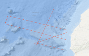
From 1st May to 25th May 2011 the French Institute from Brest Institut Français de Recherche pour l'Exploitation de la Mer (IFREMER) together with BGR conducted a scientific cruise on the IFREMER research vessel L'ATALANTE, which constitutes the 1st leg of the MIRROR survey. In order to acquire supplementary marine geophysical research data to the MIRROR scientific survey a 2nd leg was performed from 2nd June to 11th June 2011. Both legs are spread over the shelf edge and slope of Morocco, the adjacent Essaouira Rise, and the easternmost abyssal plain, and are located between 33°30' N and 30°30' N. The region of MIRROR Leg 2 is situated south of Leg 1. The main research objectives were to image the deep structure of the crust, to test the origin of the magnetic anomaly S1, and to test rifting models in order to understand the nature of the continental margin of Morocco as well as the opening history of the Atlantic Ocean. Another objective was to realize a comprehensive sediment basin analysis for specifying the hydrocarbon potential of the region. In total multi-channel seismic lines with a length of 1,391 km and additional 271 km with the other geophysical methods (magnetic field measurements as well as bathymetry) were acquired. The seismic data acquired during Leg 2 were processed onboard and two of the lines were interpreted. Line BGR11-208 traverses from DSDP Site 415 to Site 416 and ties the MCS grids of both MIRROR legs as well as other former MSC surveys of BGR. Therefore, the line enables a reliable regional seismostratigraphic interpretation and a moderately well mapping of the Jurassic, Cretaceous, and Cenozoic sequences. Large compressional structures are present in the sedimentary cover along the seismic line pointing to transform faults or an activated fracture zone. Regarding the NWW-SEE trending line BGR11-202 the area of investigation can be subdivided into three structural units, a zone of rifted continental margin, a zone of initial seafloor spreading, and a zone of regular seafloor spreading as well as post-Cretaceous igneous activity. Huge rotated basement blocks are located under the shelf and uppermost slope and striking salt domes at the lowermost slope. The zone of initial seafloor spreading is characterized by a sub-basement reflector with overlying tilted basement blocks. The sub-basement reflector trends generally horizontal and appears to be a detachment fault. The magnetic slope anomaly S1 is located at foot of the slope near the western boundary of the zone of rifted continental margin.
-
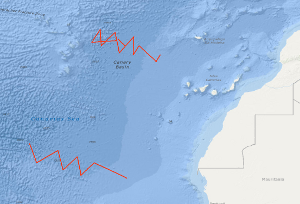
In continuation of a fracture zone survey of BGR in 1985, there was a multichannel seismic survey of the Hayes Fracture Zone between 20°W and 27°W in the time from October 26th to November 11th, 1988. In spite of bad weather conditions, it was possible to collect a total of 1.760 km seismic and gravity data on 11 lines. From a first interpretation of the seismic monitor records on board it appears that the frequency of intra-crustal reflections in the records from the area west of 20°W is much less than on the records of the survey of the previous cruise in 1985. During a second leg in the time period from 14th November to 21th November 1988 an additional seismic survey of the Kane Fracture Zone took place with 7 supplementary profiles.